The Khmer city that preceded present-day Sakon Nakhon appears to have been the empire’s most important outpost north of the Phu Phan Mountains (Though it was probably not under direct rule from Angkor, rather the leaders paid tribute as a satellite state while retaining a degree of independence.) from around the late 10th century into the 13th; no doubt in large part because the 125-square-kilometer Nong Han lake assured abundant water year-round. Salt was also a factor, and it was so plentiful that it was shipped all the way to Angkor.
The Khmer abandoned the town (sometimes referred to as Nong Han Luang, though what the Khmer actually called it is unknown) after King Jayavarman VII (r. 1182-1219) died and later Lan Chang Lao moved in from across the Mekong to settle a city they called Chiang Mai Nong Han (“Nong Han New City”), appropriating the Khmer prang Phra That Choeng Chum (พระธาตุเชิงชุม) for Buddhism.
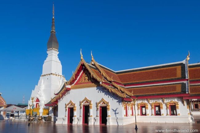
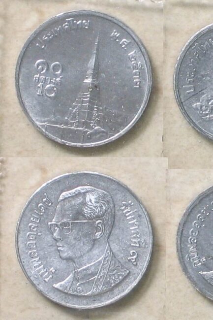
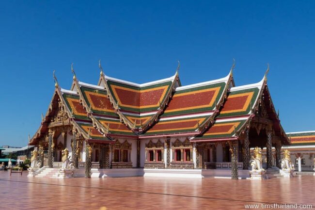
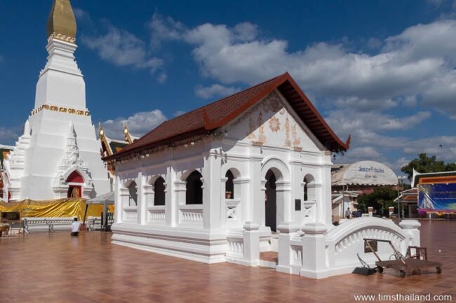
Today this site is home to the city’s most important temple, Wat Phra That Choeng Chum Worawihan, and though most of the Khmer construction is gone, the prang remains at the heart of it. The name Phra That Choeng Chum means “Stupa of the Gathering of the Footprints” because, legend says, it was built above footprints left by the last four perfect Buddhas: Kakusandha, Konagamana, Kassapa, and Gautama. And eventually this eon’s fifth and final Buddha, Maitreya, will come leave his mark too. Due largely to this legend, the temple is known nationally and once backed the ten satang coin.
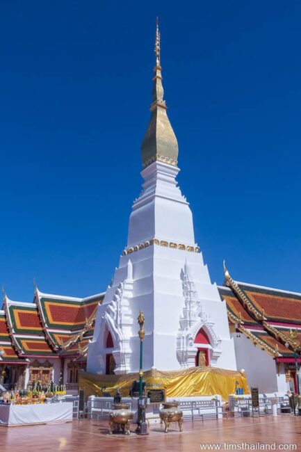
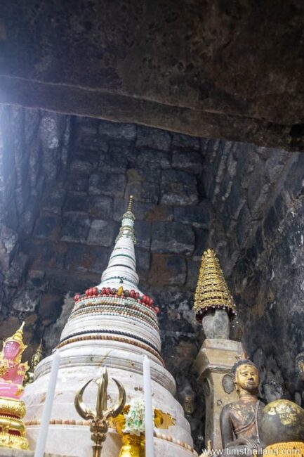
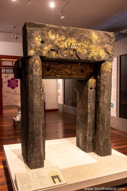
The original Khmer stupa, built of laterite blocks probably in the 11th century, was covered up in the 17th century by the Lao and later modified further under Thai rule. It’s now a gleaming white 23.5-meter-tall spire, it’s top covered with gold and holding a solid gold chat “umbrella.” But if you look inside, you can see the original walls.
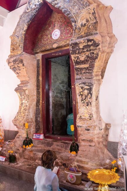
From the adjoining wihan, you can peek in through the solid sandstone doorframe, though the monks no longer let people walk inside the prang. (I was able to do it about 15 years ago.) Men (but not women) can enter the small passageway to get a closer look through the security gate.
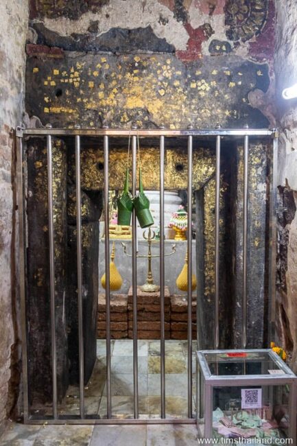
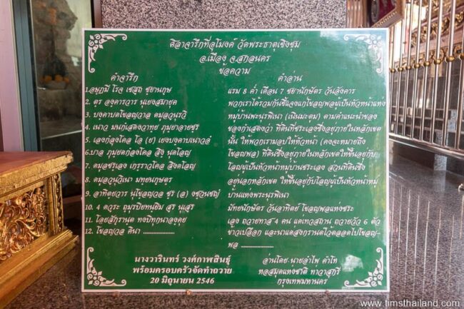
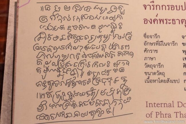
Inside the doorway, clearly visible on the right-hand side, is an inscription written in old Khmer. It’s a dedication informing that a local leader donated the land and other things including four workers (or slaves – this distinction is never clear in Khmer inscriptions) to tend to the temple, six cows, and rice.
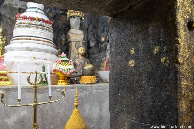
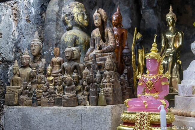
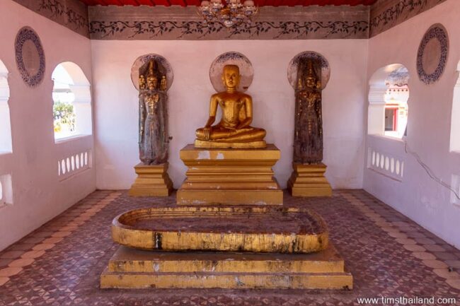
When the prang was built, there was likely a Shiva linga in the center. While it has vanished, a well-preserved Shiva statue and several other artefacts can be seen in the Sakon Nakhon Museum. Nowadays a big modern platform holds a small white marble stupa covered with beads and many Buddhas, both old and new: none of them that are visible appear to date to Khmer times.
The beautiful brick and stucco decoration around the passageway is Lan Chang, not Khmer.

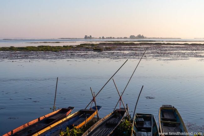
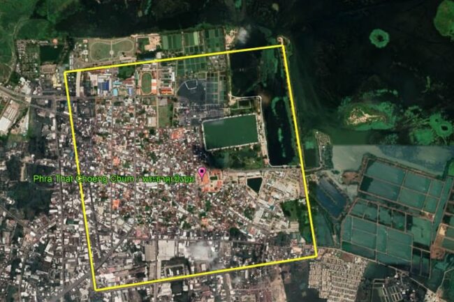
A 210m-by-400m baray, now called Sra Pangthong (It’s said that this name is a Thai-ified version of the Khmer word trapang, meaning a lake dug by people.), sits just 230 meters northeast of the stupa in Suan Somdet Phra Srinagarindra park. Unfortunately, some people in the local government have taken the silly idea of Phra That Phu Phek‘s “Zodiacal Solar Calendar” seriously and have put up a display about it in the park.
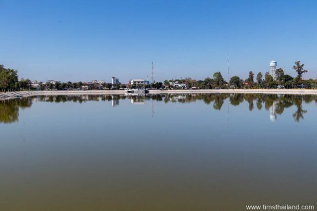
The Khmer also dug a moat around the town and temple. While the waterway is gone, its extent is still visible from above because Thanon Kumuang (“City Moat Road.”) and some other roads follow its path.
Other Things at Wat Phra That Choeng Chum
Wat Phra That Choeng Chum is one of Sakon Nakhon’s principal tourist attractions and there is a lot more to see than just the stupa, including these highlights.
Ubosot Murals
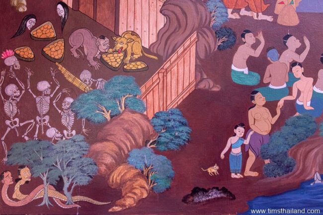
Alongside the prang and wihan is a beautiful modern ubosot built in Lan Chang style with a wide sweeping roof. Inside are wonderful murals of Jataka tales, the Ramakien, scenes of local life, and more done in a classic style.
Old Ubosot
Next to the stupa is a small century-old ubosot built in 1920 by Vietnamese craftsmen. Its open-air design is typical of the time; though unusually it faces south, not east. It has three old Buddha statues and a Buddha footprint.
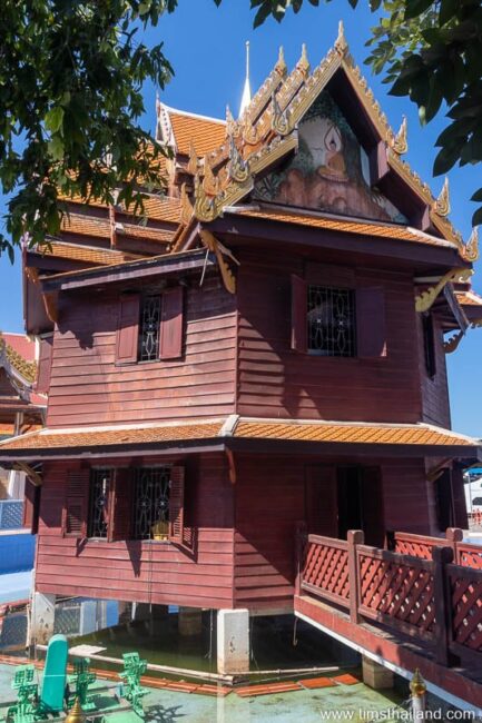
Manuscript Library
In the southeast corner of the temple is a unique octagonal haw-dtrai set in a small pond, which is home to many giant frogs. It once held a small historical museum, but at present is nearly empty.
Details – The wihan is open 7am-7.30pm daily.
Location – Wat Phra That Choeng Chum Worawihan, Tambon That Choeng Chum, Amphoe Mueang, Sakon Nakhon Province
Other Names – That Choeng Chum (ธาตุเชิงชุม), Prasat That Choeng Chum (ปราสาทธาตุเชิงชุม)
Further Reading
Boonpok, Duangden. “การผสมผสานทางวัฒนธรรมในแอ่งสกลนคร: กรณีศึกษาเขมร ลาว และไทย An acculturation in Sakon Nakhon Basin: a case study of Khmer Laos and Thai.” Veridian E-Journal, Silpakorn University, Jan-Feb 2019
Hendrickson, Mitch. “Arteries of Empire: An operational study of transport and communication in Angkorian Southeast Asia (9th to 15th centuries CE).” PhD diss., University of Sydney, 2007.
Coin photo by Lerdsuwa from Wikipedia.
4 thoughts on “Phra That Choeng Chum Khmer Ruin”
The only known ‘road’ known in Isan connects Angkor and Phimai, a prehistoric trade route enforced in stone in the 11th-12th centuries. Late 12th century inscriptions mentions other roads to named cities, we have not yet identified, but the locations of Jayavarmen VII’s ‘hospital shrines indicate where to look. I miss a ‘hospital’ at Sakon Nakhon, which apparently was a large settlement. Further west along the foot of the Phu Phan mountain chain we find two ‘hospitals – marking the border of Jayavarman’s Empire. The Angkorian temples in Sakon were build by local leaders with fancy Khmer names and loyal to Angkor, but not under direct control and administration of the Angkorian kings.
NB: I was actually googling for an old aerial photo of the Sakon Nakhon city moat, which interestingly has a Hindu sanctuary located nearly in the center.
Thanks for the comments.
I’m not sure where you get the idea that this city was not directly control by Angkor? There is a road system that link this city directly to Angkor which indicates imperial control. This city is not the most northern outpost of the Khmer empire. There is a road system from this city that goes all the way to Vientiane Laos which is another Khmer outpost.
Hello. Actually, I did not say either of those things. I said that Sakon Nakhon was the “most important” northern outpost, not the northernmost. I also wrote that Sakon Nakhon “probably” kept some degree of independence, and this is mentioned Mitch Hendrickson’s PhD thesis, “Arteries of Empire” that is linked at the end of this article: “Groslier argues correctly that the Angkorian Khmer felt most ‘comfortable’ between the Tonle Sap and Mun River on the Khorat Plateau (1986:39). Although there are examples of sites outside this ‘comfort zone’ such as Muang Singh on the Myanmar border and Prasat Narai Jaeng Waeng in Nakhon Sakhon, northeast Thailand, these sites likely represent enclaves rather than evidence of direct Angkorian territorial control.” I don’t think there is any dispute amongst scholars that the outer reaches of the Khmer empire were mostly under the suzerainty of the kings in Angkor, but feel free to suggest some articles that do if you know of any.